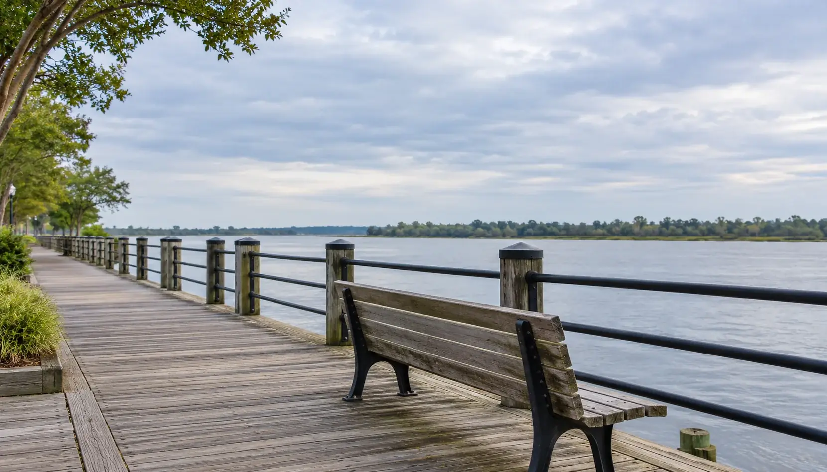
You can enjoy the Wilmington Riverwalk without walking its entire length. For a short outing before lunch, start at Dock Street, follow the waterfront south to Nun Street and return the same way. If you want a longer walk, the full route connects the southern waterfront with the north end near the Isabel Holmes Bridge, but leave enough energy for the trip back.
The city lists the Riverwalk as 1.75 miles one way, from the foot of Nun Street to the bridge. Walking both directions makes that about 3.5 miles before you add the walk from your parking space. Along the way, the Cape Fear River stays beside you, with views toward Battleship NORTH CAROLINA across the water and downtown streets close enough for a meal afterward.
Choose your Riverwalk route
An out-and-back gives you a familiar return path and lets you turn around early. Pick the shorter option if walking is one part of your downtown visit, or if someone in your group needs a modest distance. Choose the full-length return walk when the walking itself is the outing.
Short stroll or full return walk?
Both options bring you back to your starting point. Parking connections and stops add to the outing.
Shared scale: 0 to 3.5 miles, including the return
Check repairs before setting out. The city began a multi-year decking replacement project in 2025. Its Riverwalk maintenance page describes work around Nun and Ann streets and the Convention Center, including structural work along the marina. An early-2026 target on that page doesn’t establish which sections are open today. Check the latest city notices and follow posted barriers or detours; shorten the walk if the available route doesn’t suit your group.
A short walk from Dock Street to Nun Street
Start where Dock Street meets the waterfront and head south with the river on your right. Stay on the Riverwalk itself; the city map distinguishes the promenade from dock spurs, some of which are private.
Stops on the short walk
Follow the waterfront south, then retrace the same path.
- Dock Street
Look for Anne Bonny’s floating barge and the view toward Battleship NORTH CAROLINA before heading south.
- Orange Street Landing
Pause for the landing’s Underground Railroad history, then continue past Wilmington Water Tours toward Ann Street.
- Ann Street
Look at the Pilot House’s relocated historic house, then pass Chandler’s Wharf toward Nun Street.
- Nun Street turnaround
Look south toward the Cape Fear Memorial Bridge, then retrace the waterfront with the river on your left.
Dock Street and the river views
Before heading south, take a look at the different ways people use the waterfront here. Anne Bonny’s Bar and Grill, at 106 S. Water St., occupies a floating barge beside the Riverwalk. You can see how its dining area sits on the water rather than in a building on the bank. It’s a useful landmark for finding your starting area, whether or not you’re stopping for food.
Across the Cape Fear, look for Battleship NORTH CAROLINA. This waterfront view lets you take in the ship from a distance, while going aboard requires a separate trip to the opposite bank. For One Tree Hill fans, the tourism bureau identifies the Dock Street “Naley Bench” as the location where Nathan gave Haley the Cracker Jack bracelet. Our Wilmington film locations guide puts that scene in context and covers other filming stops.
From Dock Street to Orange Street, keep the river on your right and follow the promenade south. Look between the waterfront businesses and the dock structures for views across the water. The city map marks several dock spurs separately from the Riverwalk; enjoy the view from the public path instead of assuming each gangway is part of the walk. This first stretch is a good place to slow down and notice the difference between the floating restaurant, the shore-side buildings and the ship across the river.
Orange Street Landing and the freedom-history stop
Pause at Orange Street Landing for the historical interpretation. The city identifies the landing as part of the National Underground Railroad Network to Freedom. Looking out over the river here, remember that the waterfront’s history includes people escaping enslavement, as well as trade and travel.
William Benjamin Gould’s story gives that history a name. The N.C. Department of Natural and Cultural Resources records that Gould and seven other enslaved men escaped Wilmington via the Cape Fear River on Sept. 21, 1862. After a Union vessel picked them up, they enlisted in the U.S. Navy. Gould kept a detailed diary of his wartime experiences. Read the landing interpretation before moving on; this stop deserves more than a quick photograph of the water.
Between Orange and Ann streets, watch for Wilmington Water Tours at 212 S. Water St.. The operator describes its Riverwalk kiosk with a pirate figure and postcard rack, so those are useful details to look for. Its boat, the Wilmington, is an enclosed motor catamaran. If it’s at the dock, you can compare an excursion boat with the much larger Battleship across the river. Departures change what you’ll see, and boarding a cruise is a separate booked activity that adds time beyond this walk.
Ann Street and the historic waterfront restaurants
At Ann Street, look toward the Pilot House and Elijah’s, both listing their address as 2 Ann St. The restaurant buildings carry stories from before the Riverwalk became a visitor destination. According to the Pilot House’s own history, William Craig built its original house as a residence in 1870. Craig was a cooper, a maker of wooden barrels. The house was moved here from Wooster Street in 1977, and the restaurant opened in 1978. You’re looking at a relocated historic house, so its age and its time on this waterfront are two different things.
The building that houses Elijah’s was a maritime museum before the restaurant opened in 1984, according to the restaurant’s history. Paintings, ship models and nautical artifacts remain on display inside. You won’t see that collection simply by passing on the promenade, but it gives a meal stop an extra point of interest. Ask staff about looking around when visiting the restaurant, and keep its dining deck separate from the public walking route.
From Ann Street toward Nun Street, notice the buildings of Chandler’s Wharf on the landward side. The Downtown Business Alliance describes the complex as the former Calder-Thorpe Warehouse, built in 1884 and rehabilitated in 1978, with shops, galleries and restaurants. The wharf’s older trade included tar, pitch and turpentine, products used in wooden ships. With that history in mind, the waterfront buildings become more than a backdrop for lunch. Stay on the promenade for the short route, or add time to browse whichever businesses are open.
Nun Street and the southern turnaround
At the foot of Nun Street, pause before retracing the waterfront. Look south along the river toward the Cape Fear Memorial Bridge. The city describes it as a vertical-lift bridge: its movable center section rises for taller marine traffic. The bridge is a different landmark from the Isabel Holmes Bridge at the Riverwalk’s northern end. You can look toward it from this southern stretch without adding a bridge crossing to the itinerary.
If historic houses interest you, Nun Street also gives you an optional inland detour toward South Front Street. The Historic Wilmington Foundation identifies the Governor Dudley Mansion at 400 S. Front St. as the former home of North Carolina’s first popularly elected governor and a former headquarters of the foundation. Keep an exterior look to public sidewalks; this route doesn’t include entry to the house or grounds. The detour adds distance beyond the waterfront estimate.
For the short walk, turn north at Nun Street and return past Ann and Orange streets to Dock Street, with the river on your left. Use the return to look at anything you passed on the way out, or make the meal stop you saved until everyone had finished walking. Our downtown Wilmington restaurant guide can help you choose where to eat afterward. If you continue north beyond Dock Street toward Market Street, that extension also adds to the short-route distance.
Walking the full Riverwalk and getting back
For the full south-to-north route, begin at Nun Street and continue past Ann, Orange and Dock streets toward Market Street. From there, keep following the designated waterfront route north toward the Convention Center and marina, then the Riverfront Park area and the northern end near the Isabel Holmes Bridge. Crossing the bridge is outside this itinerary. Use the city map for orientation and current signs for any change in the path.
This longer outing lets you see more than the central downtown waterfront. Riverfront Park offers a possible break near the northern part of the walk, with gardens and a playground among its listed amenities. That makes the park useful as a destination in its own right, particularly if the group would enjoy a play break more than reaching the end of every section.
Decide on the return before you leave Nun Street. Walking back gives you the roughly 3.5-mile total, so a leisurely outing with breaks can take much of a morning or afternoon. If you only want to walk one direction, arrange your ride in advance and choose a legal street-side pickup point with the driver. Don’t assume a vehicle can reach you on the promenade or that transport will be waiting at the northern end.
The Battleship view can also prompt a change of plan. Seeing the ship across the river doesn’t make its entrance a stop on this walk. If you want to go aboard, use our Battleship NORTH CAROLINA visitor guide to plan that separate visit.
Parking near your starting point
Choose parking for the walk you intend to take and leave time to get from the car to the waterfront. A parking deck’s address is not the route’s starting line.
The city’s downtown parking page lists the Second Street Deck at 114 N. Second St. For ordinary daily parking, the first hour is free, up to two hours costs $3 and up to three hours costs $4. It suits a central downtown arrival if you’re comfortable walking to Dock Street for the short route.
River Place Deck, at 14 Grace St., offers another central arrival point. Its ordinary daily rates are $2 for up to one hour and $4 for up to two hours. For a north-end start, the Convention Center deck at 515 Nutt St. has its entrance at North Water Street and Estell Lee Drive. From that deck, choose a north-end section and return to the same parking area. The full-route distance in the comparison applies to a Nun Street start.
Availability and special-event pricing can change your parking choice, and private lots set their own terms. Read the posted price before entering and allow time for the parking connection when deciding how long to stay.
Public restrooms and places to pause
Make a restroom plan before a long walk, especially with children. The clearest city-listed public option for this itinerary is Riverfront Park at 10 Cowan St., toward the north end. The city lists public restrooms there and gives general park hours as sunrise to sunset, except for city-approved events or programs. That doesn’t guarantee independent restroom access at every hour or during every event setup.
Riverfront Park also has lawn areas, gardens and a playground, so you can make a longer pause there instead of immediately walking back. Concerts affect how the park is used. The city says the East Garden and playground remain open on concert dates, with access through the Nutt Street Promenade; follow the day’s signs rather than walking through a ticketed event entrance.
Don’t confuse this park with Water Street Park opposite the Federal Courthouse, closer to the central downtown waterfront. Older descriptions may call that smaller park Riverfront Park. For the short southern walk, use a restroom before setting out and ask about facilities when stopping at a business. A restaurant address alone doesn’t mean its restroom is available to noncustomers.
Bring water and choose a turnaround that leaves enough energy for the return. If you use a wheelchair, mobility aid or stroller, check the current approach and detour before choosing the distance. This is an outdoor promenade with ongoing maintenance; a mapped connection isn’t a guarantee that today’s surface, access point or alternate path will work for everyone.
Leave time to enjoy the waterfront
For a first visit, the short route gives you room to read the landing interpretation, look at the waterfront buildings and decide where to stop afterward. Leave extra time if you want to browse Chandler’s Wharf or add the exterior walk toward the Dudley Mansion.
Before heading back to the car, pause at a permitted spot along the railing and look across the Cape Fear. Leave a few minutes for that view, even if it means turning around before the end of the Riverwalk.